- Thumbnail
- Resource ID
- 2c2d8e9b-d80c-460a-aa37-8d096c7d761b
- Title
- Active Licences
- Date
- Aug. 9, 2019, 8:59 a.m., Revision
- Abstract
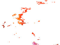
- The geodatabase on offshore hydrocarbon licences in the EU was created in 2015 by Cogea for the European Marine Observation and Data Network (EMODnet). It is the result of the aggregation and harmonization of datasets provided by several EU and non-EU sources. It is updated every year, and is available for viewing and download on EMODnet - Human Activities web portal (www.emodnet-humanactivities.eu). The database contains polygons representing active offshore hydrocarbon licences in the following countries: Croatia, Denmark, Germany, Ireland, Italy, Malta, Netherlands, Norway, Poland, Portugal, Spain and UK. Where available each polygon has the following attributes: country, code, name, type (exploration, exploitation), licensing round, area (square km), area info (it indicates if the attribute value is original from the source or has been calculated) starting year, ending year, operator.
- Edition
- --
- Owner
- Cogea.srl
- Point of Contact
- lfalco@cogea.it
- Purpose
- --
- Maintenance Frequency
- None
- Type
- not filled
- Restrictions
- otherRestrictions
- Re-use of content for commercial or non-commercial purposes is permitted free of charge, provided that the sources (both EMODnet - Human Activities, and primary sources) are acknowledged. EMODnet - Human Activities accepts no responsibility or liability whatsoever for the re-use of content accessible on its website.
- License
- Not Specified
- Language
- eng
- Temporal Extent
- Start
- --
- End
- --
- Supplemental Information
- No information provided
- Data Quality
- Data were retrived from 12 different sources. Validation and quality assurance remain up to primary data sources, while harmonization is carried out by Cogea. The harmonisation process consisted of identifying a set of attributes common to all the different datasets, thus creating a single data model. To do so, it was necessary to define a homogenous set of variables for each attribute. Therefore, raw data attributes may use a different terminology, although the information contained remains basically the same. For further information on validation and quality assurance, it is suggested that primary data sources are contacted. Generally speaking data are to be considered very reliable, because they come from national sources officially in charge for their collection. Data on licenses in Poland were digitized from an hard copy map. In Spain, Gaviota is a storage licence (almacenamiento) that was harmonized as'other' type. When areas had to be calculated we used as much as possible the original projected coordinate system of the raw data or the UTM-WGS84 zone that the national data falls in.
- Extent
-
- x0: -15.199999999999999
- x1: 36.329999999999998
- y0: 34.180000000000000
- y1: 74.500000000000000
- Spatial Reference System Identifier
- EPSG:4326
- Keywords
- no keywords
- Category
- Planning Cadastre
- Regions
-
Global